Gå til innhold
  • Bli medlem

3 dager på Møre (oktober 2006)


pb

Anbefalte innlegg

Torsdag-Lørdag ble tilbragt på Møre. Vi besøkte Såtbakkollen - 1840m, Nordre Slåtthøa - 1837m og
Dalegubben - 1344m. Dette er alle store fjell, hver med over 950 meter primærfaktor. I disse traktene
starter turen nær null meter, som betyr heftige 1800 meter opp på de to førstnevnte toppene.

Turbeskrivelse følger, se også http://www.ii.uib.no/~petter/mountains.html for (mange) flere bilder.

Torsdag:

How to get there:

The trailhead is in Sunndalen. From the Sunndalsøra hotel, drive 15.7 kilometer in the direction towards Oppdal (up the valley). As you cross a bridge, pay attention and make a sharp right just after the hilltop. This small road has a sign for Hoås. Drive a few hundred meter as this road turns back and runs under the main Hwy. bridge. Do not drive under this bridge, park on your left just as you see the bridge ahead of you. This is the trailhead, location N62:37.893, E008:50.589, elevation 98 meter.
Note that this trailhead is new and therefore not marked on the map. The old trailhead is now closed.

Route description:

From the trailhead (parking), continue along the road as it passes under the bridge. About one hundred meter further, just as the road gently curves left, locate signs for Innerdalen and the small, but clearly marked trail that leaves the road and heads uphill to your right.
The trail is marked with red "T" as well as small sticks along the first (new) section as it contours around a farmers field. Higher up, the trail climbs more steeply before merging with the old trail (coming from the right).
The trail continues steeply uphill with zig-zags. Eventually, it reaches a distinct (broad) shelf and heads left in a much more level fashion. You pass a small hut, contour elegantly around and enter the lower part of Tverrådalen, where the trail crosses the creek on a very nice natural bridge formed by two large pieces of rock.
From here, leave the trail and head directly up towards the first summit (1632 on the map). This summit is called Såtbakkollen on the map, generally agreed to be wrong. The terrain is easy with rocks on the final part before reaching the very flat summit. From here, you can see the summit and most, but not all of the remaining route. Continue across (minimal loss of elevation) to a slightly higher summit, then across a wide, but more distinct ridge to a third summit (location N62:40.453, E008:48.830, elevation 1687 meter) located on the ridge. From here, the ridge is more narrow and its final section, a deep notch followed by a steep section of rock, looks intimidating. However, things are not as bad as they may look. The scramble along the ridge is straightforward until you reach the notch. Carefully downclimb to the bottom (YDS class 3), then climb directly up the other side (also YDS class 3). The route is indicated on this picture.
From the top of the notch, continue on very easy terrain to the summit.

Note: An alternative (easier) route can be found if one enter the west side before the first summit at about 1500 meter of elevation, then cross up the somewhat steeper, but short section to the large and gentle area above, along a line that looks easy. This variation (avoiding the ridge) is likely YDS class 2 (off-trail hiking).

Comments:

I did this climb with my son Pål Jørgen. We left the car at 0730 and hiked to the nice, natural bridge across the creek from Tverrådalen in approximately 2 hours. The view back into Sunndalen is truly impressive. We rested there, then climbed up on the first part of our mountain and traversed along the high ridge to the gentle summit plateau. The ridge route looked pretty difficult from the highest summit along the ridge, but we decided to give it a try. To our great delight, the route turned out to be "just right". While I took pictures from the sharp saddle, Pål Jørgen started exploring upwards and soon shouted down that the route was "open". We arrived at the summit shortly after 1215, rested and had lunch. The view all around is truly breathtaking. Naturally, we enjoyed seeing Trolla (1850m), that we climbed in September last year. We signed the summit register. The last visitor was back in August. We were number 16 and 17 to visit this fine summit in 2006. The cliffs overlooking Innerdalen are very steep and the view correspondingly impressive.
We left at 1245 and were back at the trailhead in 4 hours, at 1645.
Good luck with the weather, it rained as we left Sunndalsøra, but this stopped by the time we were at the trailhead. Then, a nine hour hike with mostly sunny weather, only a few clouds now and then. As soon as we started driving, the rain came back and lasted for several hours.
Our late fall mountaineering trip continued the next day with a successful climb of Nordre Slotthøa.

Fredag:

How to get there:

This mountain is located east of the lake Eikesdalsvatnet. This lake, filling most of the Eikesdalen valley, has high and impressive mountains on all sides. The area is located between the villages Åndalsnes (west) and Sunndalsøra (east). This is in Nordmøre, a part of Møre og Romsdal county.
First drive to Eresfjord, located on Hwy. 660, a section of the road connecting Åndalsnes and Sunndalsøra. This place is very small, a combined gas station, grocery store and cafeteria are the only services. Continue south in the direction of Eikesdal. The road runs on the left (east) side of the lake and soon enters a 4 kilometer tunnel (narrow with meeting places). Immediately after exiting this tunnel, make a right turn (at the Vike farm), drive a short stretch downhill and make a second right turn. There is a sign here saying parking for Reinsvassbu. Park off the road in order not to block farm activities. This is the trailhead, location N62:34.190, E008:10.808, elevation 53 meter.

Route description:

Walk back along the road and continue on a small road that intersects the Hwy. a bit further down than were you turned off in order to park the car. Cross the Hwy. and head uphill on a small road that serves as access to a couple of rental cabins (owned by the Vike farm). As you reach these cabins, the road ends and a clear trail marked with red "T"s, heads uphill through the forest. You will see the horizon fairly high above. The good news is that the uphill really ends there, the bad news is that this is a long and steep hill. The trail is fairly direct with few zig-zags, but a significant uphill angle as you climb higher and higher above the Eikedalsvatnet lake.
As you top out, the valley in front of you is indeed very flat. The objective of the hike, the Northern Slotthøa is very dominant as it sits pretty much in the middle of the valley as seen from this end. The trail crosses the river on a badly broken bridge then continues along the easy, flat valley to a couple of small cabins at Kolstadstølen, elevation about 940 meter.
Slotthøa is looming 900 vertical meter above you just across the valley. There are several possible routes. If the objective is to find the easiest route, then it is likely that a YDS class 2+ route can be found going up on the left (east) side of the small glacier that is located in the middle of the big north slope. Accepting some class 3 scrambling along the route makes for more variations. A good route may follow the faint ridge line coming down on the right (west) side of the slope until the terrain turns steeper, then traverse left until near the small glacier. Scramble up along the rock ridge just next to the glacier, this is (YDS) class 3 terrain. From the top of this ridge, the remaining route to the summit is gentle and easy.
An alternative would be to climb the east side and stay to the left of the small glacier. This route involves a somewhat exposed and narrow passage near the top of the ridge near the top of the glacier. The passage is technically easy, but care is needed if the conditions are wet or icy (slippery). The entire slope further down is more broken up and it is likely that a route up on this side will also involve short stretches of class 3 terrain.
A third option is ascending the glacier. In October 2006, this was hard ice with a few crevasses, ice axe and crampons would be needed. Earlier in the season, an ascent up the middle with a larger, snow covered area, might be the most convenient route. However, the slope is sufficiently steep to require proper attention in order to avoid possible mishaps.
Comments:

I did this climb with my son Pål Jørgen. We started out at 0740 and it took us about 2.5 hours to reach the base of the mountain near Kolstadstølen, where we rested and considered the route up the broad north slope of Slotthøa. The best route (as evaluated from our position) seemed to head up along the right side, then traverse (out of sight!) left higher up. This choice put us on the right side of the small glacier and required a short, but fairly steep climb up along a broken ridge (with loose rocks) in order to gain the more level part of the mountain above us. This climb was clearly YDS class 3, from our new perspective, the opposite side of the glacier looked easier and we decided to descend on that side. (OK to climb up where we went, but perhaps less attractive to descend..) It took us about two hours from the valley floor to the summit. Unfortunately, a small cloud had settled on the summit, largely destroying the very nice view. We also experienced very strong gusts of wind near the top. The drifting fog and the steep cliffs facing east made for a memorable moment on the summit of a mountain that probabely sees very few ascents per year. The cairn was rather small for such a prominent mountain.
A further complication was caused by the new snow covering (slick) rocks along the last 100 vertical meter of the climb. We descended on the opposite side of the glacier, the overall difficulty is less, however the terrain further down was more messy than what we traversed on ascent. Overall, this large north slope is not particularly attractive, mostly a long struggle across mixed terrain. We were both quite happy when finally reaching the valley floor again. The hike out the valley and back down to the trailhead went rather swiftly and we hit the car at 1740, exactly 10 hours after departure. We speeded up the final part of the descent motivated by getting to the grocery store at Eresfjord before it would close at 1800.
Our late fall mountaineering trip continued the next day with a successful climb of Dalegubben

Lørdag:

How to get there:

This mountain is located south of the city Ålesund,near the village of Ørsta. From the traffic circle in Ørsta, take Hwy. 655 and drive 24 kilometer towards Sæbø. Before Sæbø, there is a farm on your left side, one prominent building has a sign advertising "eggs". Turn left (just before the "egg building") and drive through this farm. Just after a left turn, there is a road fork with a road going right. Take this road as it heads directly towards the mountains. Ignore the first right hand forking road (it runs down to Sæbø), curve right as your road turns right then locate a small parking area on your left well before the gate that is visible further along the road. Park here, this is the trailhead, location N62:12.384, E006:27.288, elevation 22 meter.

Route description:

From the trailhead, continue along the road as it heads uphill in wide turns. There is a small trail that forks off from this road higher up. This trail may be hard to find. The trail starts at N62:12.702, E006:27.112, elevation 200 meter. This is a pretty flat section of the road, and fairly near its end. There is a (possibly dry) creek coming down just beyond where you should head uphill along the trail. This trail is marked with red paint. If you hike to the end of the road, turn back and walk until you cross the distinct small gully that looks like a dry creek. Turn uphill and locate the small red dots that shows the way uphill.
The trail will get you up above 400 meter and traverse into the very broad gully that comes down from the Dalegubben mountain. Follow this gully uphill. As you get higher, locate the lowest point on the ridge and hike up to this point. Cross the saddle and traverse left. From here, there is a pretty visible trail that will lead you to the summit. The last section is fairly steep, but not difficult. The summit has two points that compete for being the highest. Visit both points (they are only a few meter apart).

Comments:

I did this hike with my friend Arnt Flatmo and my son Pål Jørgen. We started at 1045 and made the summit at 1330 (2:45). We headed down around 1345 and reached the car at 1545 (2:00). It was a grey and misty day with rain showers. We were fairly lucky and had a quite reasonable view from the summit. The broad gully was full of ripe blueberries. Quite a few stops in order to taste these healthy and nice tasting berries.

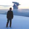
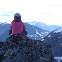
post-237-133474438524_thumb.jpg

post-237-133474438532_thumb.jpg

post-237-133474438541_thumb.jpg

post-237-133474438551_thumb.jpg

post-237-133474438559_thumb.jpg

post-237-133474438566_thumb.jpg

Vis rapporten i Turkartet

Lenke til kommentar
Del på andre sider

Annonse

Fin rapport og ditto bilder, pb. Jeg ser at du fortsatt bruker navnet Såtbakkollen. På de nyeste kartene heter fjellet Tåga, og navnet Såtbakkollen er flyttet til toppen lenger syd. Jeg er selv meget kritisk til navneendringene som kartverket driver med, men akkurat denne har jeg sansen for. Navnet Såtbakkollen på et så flott fjell har jeg alltid syntes var nedverdigende. Antagelig er det en viss tradisjon for navnet Tåga ettersom dette er kommet opp på de nyeste kartene.

Området rundt Slottshøene er meget vakkert. Ytste Snøholet ble av forfatteren Edvard Hoem, betegnet som det mest øde sted i Norge. Vandringen ut Vikebotn med karakteristiske Juratind midt i mot er en opplevelse. På en fire dagers vandring fra Vangshaugen i Sunndal til Åndalsnes, hadde vi Juratind i sikte samtlige dager.

Dalagubben er for øvrig en av mine favoritt-topper på Sunnmøre. Den beskrives i "Fotturar på Sunnmøre" som en ønsketopp for fjellfotografer.

Lenke til kommentar
Del på andre sider

Heisan,

Ja meninger og diskusjoner rundt navn er alltid vansklige.

Jeg forsoker aa holde meg til hva "FOLK" mener, dersom det

ikke er uenighet. Norsk Tindeklubb skriver temmelig KLART at

toppen heter S..kollen, ikke Taaga, de er iallefall helt klare.

Gjesteboken paa toppen sier det samme. Jeg har ogsaa faatt

dette fra annet hold.

Jeg kan absolutt vaere enig i at "kollen" ikke er veldig typisk

for det nest hoyeste fjellet i Trollheimen, men det blir feil naar

en "navnekonsulent" forsoker aa fikse opp... Da synes jeg faktisk

et etablert navn er helt OK selv om den som foerste gang kalte

fjellet "en kolle" var temmelig original.. AA flytte "kollenavnet"

ned til en av fortoppene er nok ikke noen god taktikk.

Petter

Lenke til kommentar
Del på andre sider

Bli med i samtalen

Du kan publisere innhold nå og registrere deg senere. Hvis du har en konto, logg inn nå for å poste med kontoen din.

Gjest
Skriv svar til emnet...

×   Du har limt inn tekst med formatering.   Gjenopprett formatering

  Du kan kun bruke opp til 75 smilefjes.

×   Lenken din har blitt bygget inn på siden automatisk.   Vis som en ordinær lenke i stedet

×   Tidligere tekst har blitt gjenopprettet.   Tøm tekstverktøy

×   Du kan ikke lime inn bilder direkte. Last opp eller legg inn bilder fra URL.

×
×
  • Opprett ny...

Viktig informasjon

Ved å bruke dette nettstedet godtar du våre Bruksvilkår. Du finner våre Personvernvilkår regler her.